

LLC “INGEOSERVICE” has completed laboratory 3D seismic (interpretation) work on Nyarmeysky and Skuratovsky LA in the framework of the agreement on a detailed study of the geological structure of the sedimentary cover of three licensed areas in the Kara sea shelf (Belohostrovsky, Nyarmeysky and Skuratovsky). Final report has received high appraisal from the customer.
This is not the first project of LLC “INGEOSERVICE” in this region, just offshore in the Kara sea, the company’s specialists have already processed and re-processed data of a 2D seismic survey of more than 30 thousand Lkm, and of 3D seismic survey– of more than 10 thousand sq. km. The distinguishing characteristics of work in the Kara sea is due to the complicated seismic and geological conditions in the bottom of the sea caused by the shallowness. Due to a huge amount of work done, the staff have gained invaluable experience and knowledge about the working specifics in the area. All the licensed areas of GAZPROM on the shelf of the Kara sea and the adjacent territory up to Peninsula Yamal have been studied.
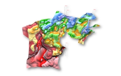
The project area of 3D cubes Nyarmeysky and Skuratovsky LA all together covers 4580 sq km. As a result of integrated interpretation of 3D seismic and well data at this site, LLC “INGEOSERVICE” has completed:
– processing of seismic data using modern software and a uniform graph of processing with true ratios of the amplitudes with the pre-stack migration;
– seismostratigraphic binding RW to the geological section of the wells.
– leveling seismic data to 2D materials in adjacent areas;
– mapped disjunctive dislocations, tectonic model of the site;
– isochrone maps and structure diagrams of reflecting horizons;
– inversion transformation;
– AVO-analysis;
– clarified geological structure and morphology of the structures and promising objects;
– dynamic, seismostratigraphic, paleotectonic and seismic facies analyses of the studied area, isopach schemes of the main sedimentary complexes;
– correlation scheme of the wells “land-sea”;
– geological cross-section through the recommended wells;
So as to complete the above enumerated operations, LLC INGEOSERVICE has implemented its own patented software complex IngeosMAP (iMAP), designed to construct digital geological models.