

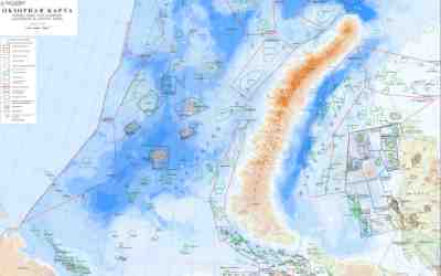
LLC “INGEOSERVICE” has completed the integrated study of the Barents sea basin and successfully presented the project to the customer. The work area has covered more than 180 thousand sq. km.
The following results have been obtained through an integrated study of the Barents sea basin:
- Reprocessing and interpretation of 2D CDPM seismic data in volume of 40 thousand Lkm have been completed.
- Seismostratigraphic positioning of RH has been conducted, as well as a detailed correlation of the target RH: B (T3 top), V2 (J2b top), V(J2k top), V/ (J3 top), Gp (K1br top), G2 (K1al), Q1 (Qbot), Q (the bottom of the sea);
- The extraction and tracing of tectonic dislocations have been performed;
- The isochron maps have been constructed, depth-velocity model has been designed , structure surfaces have been constructed for RH Q, G2, GP, V’, V, V2, B, Ia;
- Seismostratigraphic, sequence-stratigraphic, paleogeomorphic, AVO and dynamic analyses have been held;
- The maps of average and interval velocities have been designed;
- Isopachous maps of the main deposit complexes have been compiled;
- Geological aspects of promising complexes have been studied and the methodology to identify hydrocarbon traps has been developed;
- Regional schemes of promising traps in the interval of upper Devonian-lower Permian, upper Permian-Triassic, Jurassic and Cretaceous complexes of the deposits are compiled;
- Structural-tectonic zonation has been worked out;
- Prediction of AHRP is made;
- Estimation of hydrocarbon resources of the perspective objects has been completed.
Assessment of hydrocarbon potential and construction of regional geological models play an important role so as to choose main promising areas and objects of prospecting. LLC “INGEOSERVICE” has great experience in performing similar work and offers a range of regional assessment services applying know-how techniques. For example, in Eastern Siberia – within the area of Predpatomsky downfold – work has been done on the topic “Integrated interpretation of well tests, core analysis, well logging, 3D/2D seismic survey, gravimagnetic survey, electric exploration, geochemical prospecting, satellite imagery data in order to clarify the geological structure, and estimate the resource base”.