clarifying the correlation in areas of unsure horizon tracking as a result of the correlation dependence analysis of amplitudes in the effective thickness and average porosity of the reservoir;
control over the correctness of the correlation in areas of unsure tracking;
accuracy ranking of considering the permafrost formation based on the study:
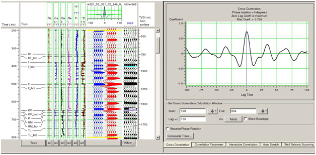
a dependency diagram of the depth of reflecting horizon occurrence (according to the well data) on the time of its registration;
emporary surface of gas-water in the massive reservoir of gas deposits;
dependency diagrams of time-depth for all the reflecting horizons;
3. Definition and tracking of tectonic disturbances in the joint analysis:
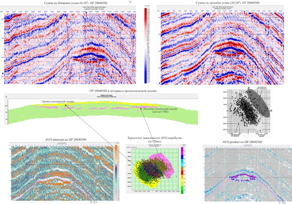
seismic section;
seismic attribute maps;
map of the first and second derivatives of surfaces;
map of curvature stretch and contour;
imap of forms;
4. Mapping isochrons:
map damping;
Map editing;
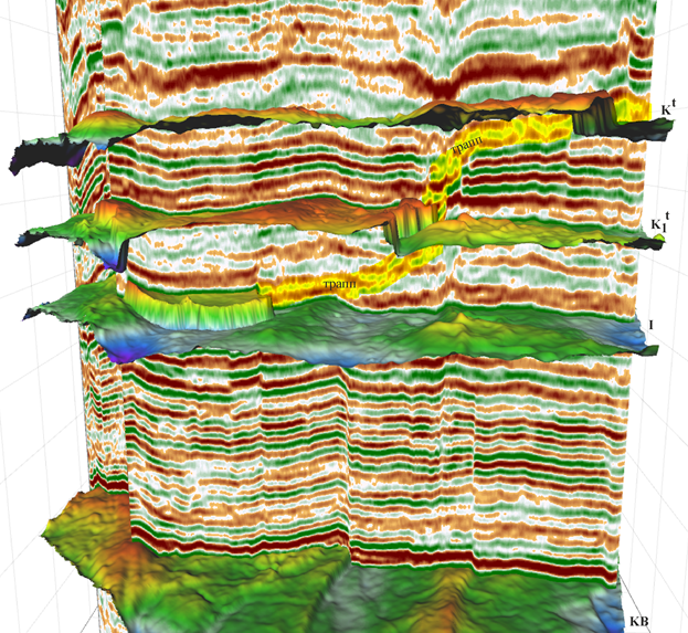
analysis of maps and their systems in a three-dimensional image;
5. A valid choice of velocity model and the implementation of structural models based on it:
calculation of vertical velocity spectra;
calculation of horizontal velocity spectra;
accuracy analysis of deep-velocity model design;
calculation of interval and average velocities for all target horizons;
6. Design and analysis of structural maps of stratigraphic surfaces in target layers and key horizons. Evaluation of reliability of structural models with:
estimation method of structural imaging errors by comparing with the data of drilling wells that are not included in the process of constructing the structural maps (validation method);
applying the key folds;
on the basis of mathematical models of the tectonic evolution history of the stratigraphic intervals in the section;
7. Seismic Inversion:
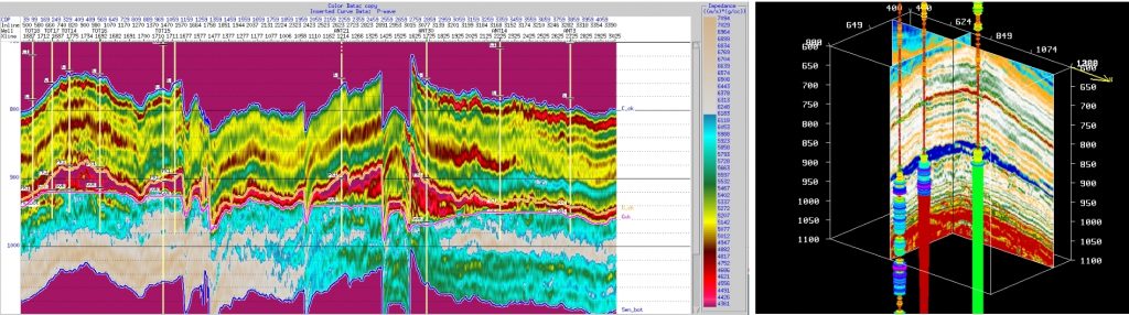
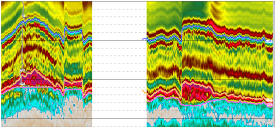
calculation of acoustic impedance section;
reconstruction of an effective model of the structure by method of simulation annealing;
AVO-elastic inversion that is based on the summation of various angles of incidence (prediction in the sections Vp, Vs, P);
Imaging of Cenomanian gas deposits in the context of pseudo-impendence of longitudinal waves. Western Siberia.
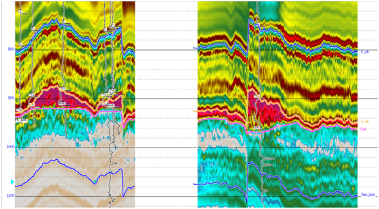
Vertical section of acoustic impedance
Vertical section of acoustic impedance in the interval of the layer PK1. North of Western Siberia.Vertical section of acoustic impedance in the interval of the layer PK1. North of Western Siberia.
A.B.C.
The results of the seismic data inversion (A) in the sections of acoustic impedances (B) and hexahedron of gamma ray curve (C) in an Eastern Siberia area.
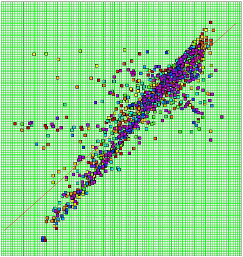
Crossplotting between the observed and predicted values of gamma logging in one of the areas of Eastern Siberia.
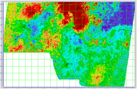
Map of predicted values K_sand in the Talakhsky horizon on one of the areas of Eastern Siberia.
The results of the simultaneous inversion in one of the areas of Eastern Siberia: elastic impedances of longitudinal waves (A), elastic impedance of transverse waves (B), pseudo-density (C) and attitude Vp/Vs (D).
the transformation of seismic sections into sections of instantaneous amplitude, frequency, phase, sections of derivatives and integrals in seismic traces;
9. Designing maps of the intensity, heterogeneity and etc. 10. Construction of seismic attribute maps and their editing that is based on the sedimentation reservoir model. 11. The seismic facies analysis:
calculation of sedimentary sections;
calculation of seismic facies sections;
definition of seismic facies as a result of the integrated interpretation of seismic, seismic facies and sedimentary sections;
seismic facies analysis of attributes sections;
delineation of paleodelt, paleochannels, paleobars, barrier islands, etc.;
Analysis and comparison of seismic and well log facies;
joint interpretation of seismic facies analysis and paleotectonic data to restore conditions to accumulate reservoir sand bodies, to determine their genesis, facies environments;
delineation of correlation relations between the amplitudes (other attributes) and effective thickness, average porosity;
prospective assessment of selected sedimentary bodies as a result of determining the reservoir saturation based on test and WLD data;
recommendations on the drilling of new exploration wells;
design of the sedimentation reservoir model based on paleotectonic and facies analysis;
14. A geostatistical analysis of seismic attributes correlations and calculation parameters of the effective thickness and coefficients of open porosity in the reservoir:
evaluation of correlations between seismic attributes and reservoir capacity in the course of a one-dimensional modeling;
search for links between the AVO-attributes and calculation parameters;
separate linkages for different conditions of sedimentation;
multi-attribute analysis using multiple regression method;
the use of neural network technology for the BER forecasting;
calculation of predictive maps of calculating parameters;
a comparison of forecast maps with forecast maps of sand bodies spread;
fidelity assessment of the volumetric data forecast;
15. Identifying and preparing new exploration targets of structural and nonstructural types for drilling;
16. Providing recommendations for drilling operation of new exploration (or producing) wells.
The company has experience in a major part of the West Siberian oil and gas province, in some regions of Eastern Siberia, the Timan-Pechora oil and gas province, Samara region, Azerbaijan.