

INGEOSERVICE LLC offers a full range of services for 2D and 3D seismic data processing, both field and marine.
The company’s specialists have vast experience in conducting work on projects of different complexity and in regions with different seismic and geological conditions. So as to perform processing work, we implement the latest software from leading world manufacturers (CGG, Paradigm), as well as our own developments (depth migration through Gaussian beams, tomographic imaging of the primary velocity model for depth migration, and a system of field quality control of seismic data).
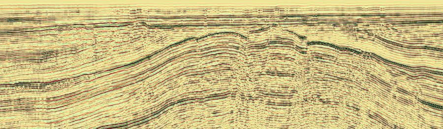
When processing field and marine seismic data, INGEOSERVICE LLC specialists carry out the following procedures:
- Construction of a depth-velocity model of the upper part of the section using tomographic inversion;
- Suppression of multiple waves for marine data applying 2D and 3D SRME, as well as constructing a model of multiple waves in shoal water;
- Regularization of data on several parameters before performing pre-stack migration, preserving azimuth information for wide-azimuth data;
- Construction of isotropic and anisotropic models for pre-stack time migration;
- Construction of an isotropic and anisotropic depth-velocity model for depth migration using layered or grid tomographic inversion;
- Performing depth migration, applying our own development of “deep migration on Gaussian beams”;
- Azimuth data processing.
The geography of seismic data processing projects is extensive:
- Marine – Barents sea, Kara sea, Caspian sea , Black sea, Sea of Okhotsk.
- Field – areas of Western and Eastern Siberia, Bashkiria, Pechora, Pre-Caspian, the North Caucasus, Sakhalin, Kamchatka and others.
The volume of the completed 3D field and marine projects is up to several thousand square kilometers each.